

Glacier National Park is a 1,583-square-mile protected area located in the northwestern region of Montana, United States. Known for its striking landscapes, diverse ecosystems, and abundant wildlife, the park features over 700 miles of hiking trails, numerous pristine lakes, and the famed Going-to-the-Sun Road. Visitors can explore the park’s natural beauty through various activities, including hiking, camping, wildlife viewing, and scenic drives. With its commitment to preserving the region’s natural resources and promoting environmental stewardship, Glacier National Park offers a captivating and educational experience for nature enthusiasts and outdoor adventurers.
Google map 4.8/5
The Best Places to Visit in the Glacier National Park
Going-to-the-Sun Road
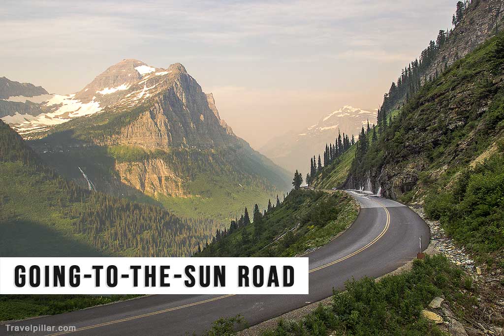
Going-to-the-Sun Road is a 50-mile, scenic mountain route traversing Glacier National Park in Montana, USA. Constructed in 1932, this engineering marvel features hairpin turns, stunning vistas, and various ecological zones. Accessible from late June to early October, it provides visitors with opportunities for hiking, wildlife watching, and photography. Notable points along the road include Logan Pass, Jackson Glacier Overlook, and the Weeping Wall. Due to limited parking, shuttle services are available to mitigate congestion.
Google map west entrance 4.8/5
Google map east entrance
Google map Glacier National Park HQ 4.3/5
Grinnell Glacier
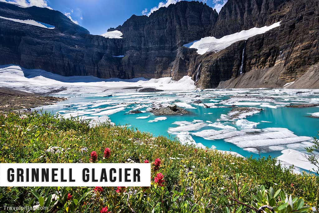
Grinnell Glacier is one of the most iconic and accessible glaciers in Glacier National Park, Montana. Named after naturalist George Bird Grinnell, it has significantly retreated in recent decades due to climate change. To reach the glacier, visitors embark on a 10.6-mile round-trip hike from the Many Glacier area, passing by three pristine alpine lakes and offering sweeping views of the surrounding landscape. Hikers should be prepared for steep inclines, potential wildlife encounters, and rapidly changing weather conditions.
Google map 4.9/5
Google map Grinnell Glacier Overlook (Garden Wall Trail) 5/5
Google map Grinnell Glacier Trailhead 4.9/5
Google map The Garden Wall 5/5
Highline Trail
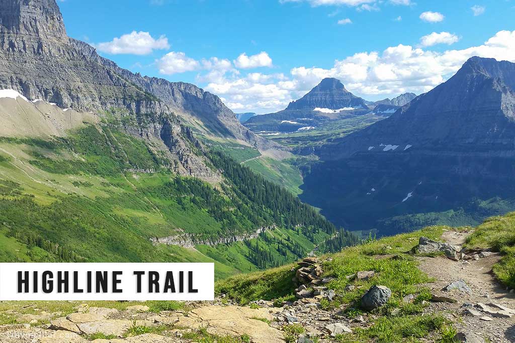
Highline Trail is a popular, 11.8-mile one-way hiking route in Glacier National Park, renowned for its breathtaking views of the Continental Divide and abundant wildflowers. Starting at Logan Pass, the trail follows the Garden Wall, leading to the Granite Park Chalet. While not technically difficult, the trail features narrow sections and steep drop-offs, requiring caution. Hikers should carry bear spray, ample water, and be prepared for rapidly changing weather conditions.
Google map Highland Trailhead 4.9/5
Google map Logan Pass Visitor Center 4.6/5
Google map Granite Park Chalet 4.7/5
Saint Mary Lake
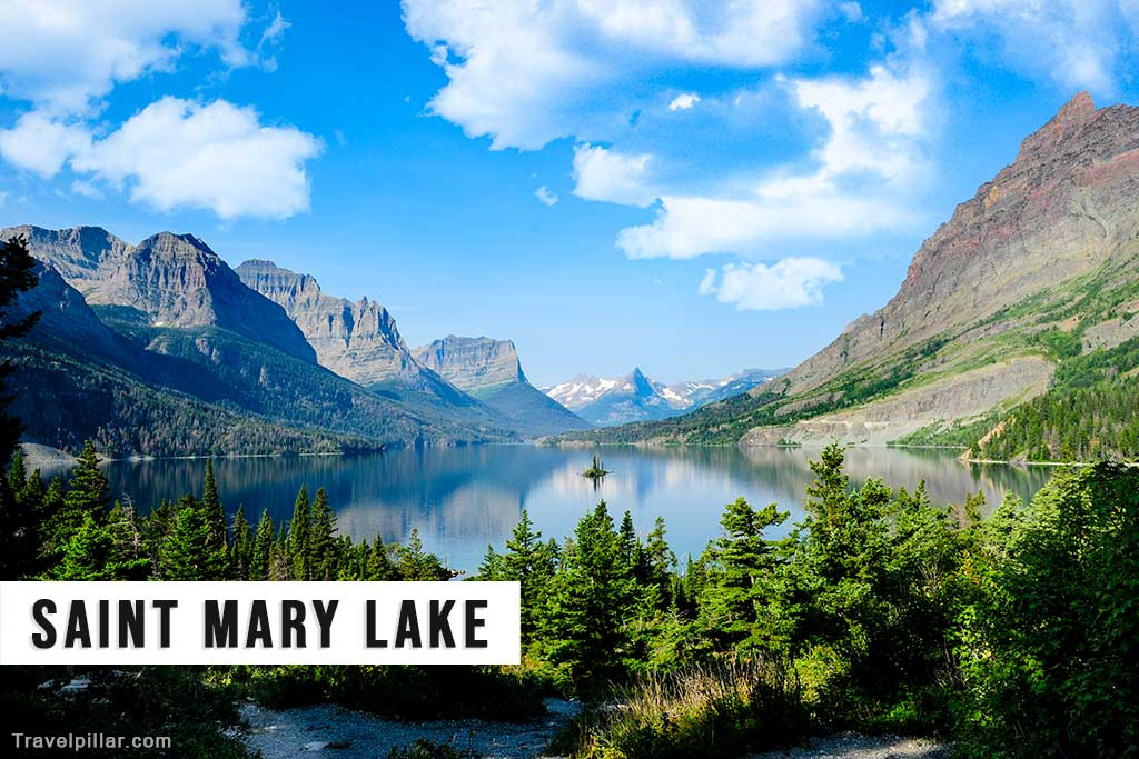
Saint Mary Lake is the second-largest body of water in Glacier National Park, spanning 9.9 miles in length and reaching depths of 300 feet. Encircled by majestic mountain ranges, this picturesque lake is situated along the Going-to-the-Sun Road, offering numerous viewpoints, picnic areas, and hiking trails. Notable attractions include Wild Goose Island, a small, iconic landmass that has become a symbol of the park, and the nearby Sun Point Nature Trail, a short hike with panoramic vistas.
Google map Saint Mary Lake 4.8/5
Google map Saint Mary Visitor Center 4.6/5
Logan Pass
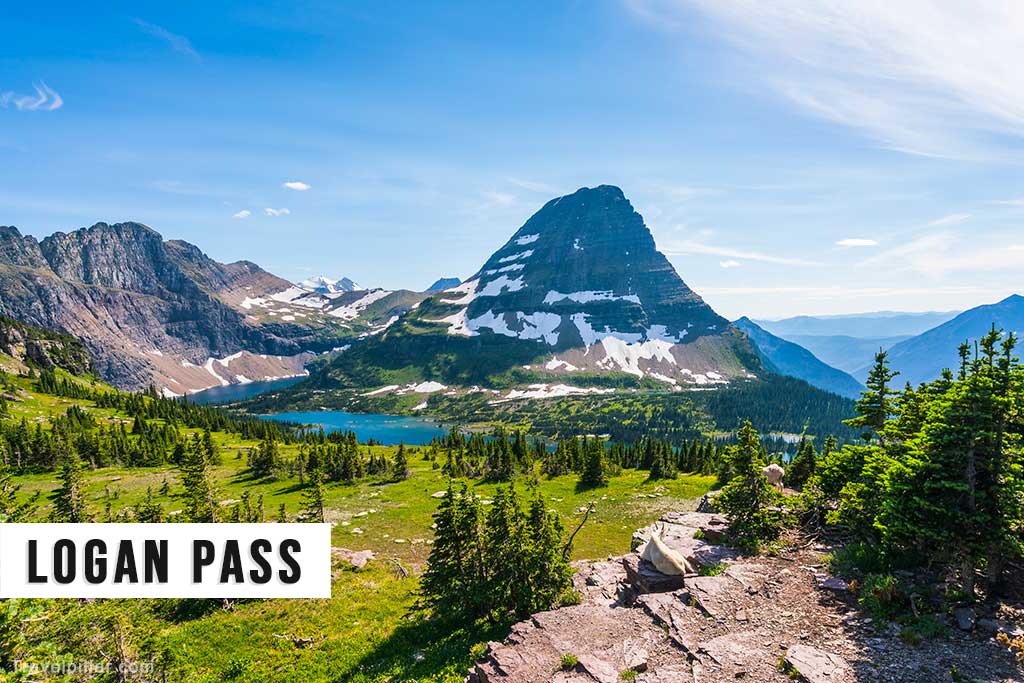
Logan Pass is the highest elevation reachable by car in Glacier National Park, standing at 6,646 feet above sea level. Accessible via the Going-to-the-Sun Road, it serves as a hub for several popular hikes, including the Highline Trail and the Hidden Lake Overlook Trail. A visitor center provides interpretive displays, restrooms, and ranger-led programs during the summer months. Due to its popularity, parking can be limited; visitors are encouraged to use the park’s shuttle system.
Google map Logan Pass 4.8/5
Google map Logan Pass Visitor Center 4.6/5
Google map Highland Trailhead 4.9/5
Google map Hidden Lake Trailhead 4.8/5
Lake McDonald

Lake McDonald is the largest and most accessible lake in Glacier National Park, stretching 10 miles long and over a mile wide. Situated near the park’s western entrance, it offers a range of recreational activities, including boating, fishing, and hiking. The Lake McDonald Lodge, built in 1913, provides accommodations, dining, and historical charm. The Apgar Village, located at the lake’s southern end, offers additional lodging, a visitor center, and a ranger station.
Google map 4.8/5
Two Medicine
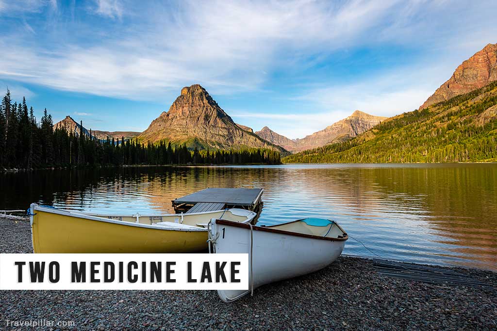
Two Medicine is a lesser-visited region in the southeastern part of Glacier National Park, known for its serene lakes, dense forests, and dramatic mountain backdrops. Once a primary hub for park visitors, it now offers a more peaceful experience with fewer crowds. The area features various hiking trails, including those to Twin Falls, Upper Two Medicine Lake, and Scenic Point. A historic general store and campground provide basic amenities, while boat tours and rentals are available on Two Medicine Lake.
Google map Two Medicine Lake 4.9/5
Google map Lower Two Medicine Lake 4.9/5
Google map Upper Two Medicine Lake 5/5
Google map Two Medicine Road (turning off Highway 49)
Google map Continental Divide Trailhead 4.7/5
Many Glacier

Many Glacier is a region in the northeastern section of Glacier National Park, renowned for its spectacular mountain scenery, abundant wildlife, and access to numerous hiking trails. Swiftcurrent Lake and Lake Josephine are focal points, framed by iconic peaks such as Mount Grinnell and Mount Gould. The historic Many Glacier Hotel, built in 1915, offers lodging, dining, and ranger-led programs. Popular trails in the area include Grinnell Glacier, Iceberg Lake, and Ptarmigan Tunnel.
Google map Many Glacier Ranger Station
Google map Many Glacier carpark
Google map Many Glacier Hotel 4.6/5
Google map Swiftcurrent Lake 4.9/5
Google map Lake Josephine 5/5
Google map Grinnell Glacier Trailhead 4.9/5
Google map Apikuni Fall Trailhead 4.7/5
Google map Route 3 (turning of Highway 89)
Iceberg Lake Trail
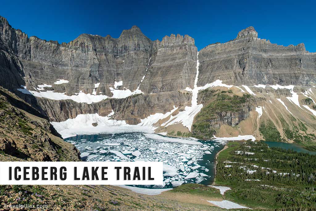
Iceberg Lake Trail is a 9.7-mile round-trip hike in Glacier National Park, starting from the Many Glacier area. Renowned for its picturesque alpine landscapes, the trail takes hikers through meadows, forests, and along steep cliffs, ultimately arriving at the stunning Iceberg Lake. Named for the floating ice chunks often present during summer months, the lake is surrounded by towering cliffs and offers a dramatic backdrop for photography. Hikers should carry bear spray and be prepared for variable weather conditions.
Google map Iceberg Lake 4.8/5
Google map Iceberg Ptarmigan Trailhead 5/5
Google map Many Glacier Ranger Station
Google map Many Glacier carpark
Virginia Falls

Virginia Falls is a picturesque, multi-tiered waterfall located in Glacier National Park, accessible via a moderate, 3.6-mile round-trip hike from the Going-to-the-Sun Road. The trail passes by St. Mary Falls, another popular waterfall, before continuing to Virginia Falls, which plunges approximately 50 feet into a scenic pool. The hike offers a mix of forested terrain, wildflowers, and glimpses of the surrounding mountains. Hikers should carry bear spray, wear appropriate footwear, and be prepared for possible slippery conditions near the falls.
Google map Virginia Falls 4.9/5
Google map St. Mary Falls 4.9/5
Google map St. Mary Falls Trailhead & shuttle stop 4.9/5
Google map Saint Mary’s Falls Parking Lot