
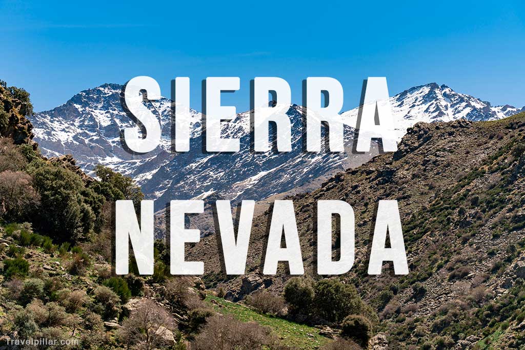
The Sierra Nevada is the highest mountain range in mainland Spain and forms part of the Baetic System in Andalusia. Located east of Granada, it contains Mulhacén (3,479 metres), the highest peak on the Iberian Peninsula. The range extends across the provinces of Granada and Almería and is protected as both a National Park and a Biosphere Reserve, reflecting its ecological and geological significance.
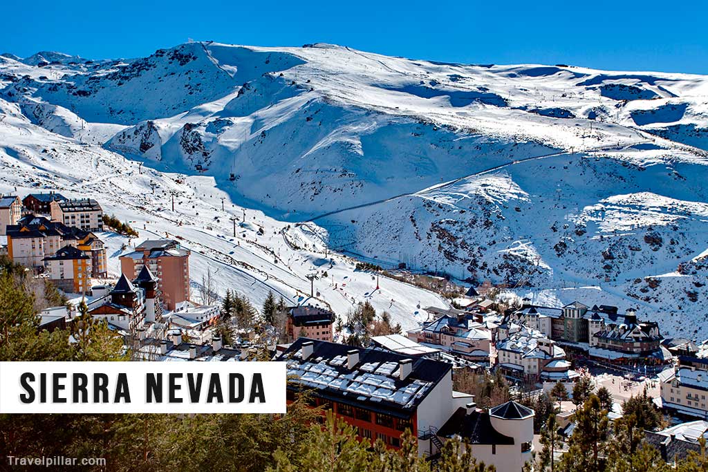
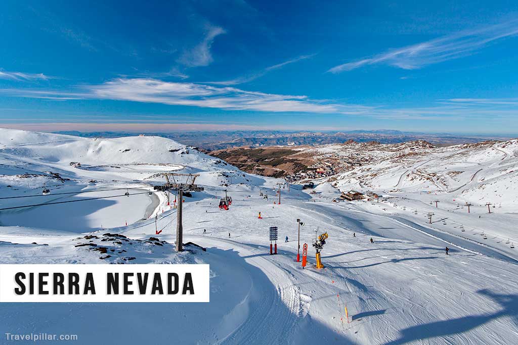
The landscape is defined by high-altitude peaks, glacial valleys and seasonal snowfields. In winter, the upper slopes support one of Europe’s southernmost ski resorts, centred near Pradollano. The ski area provides developed infrastructure including lifts, accommodation and road access from Granada. Snow conditions vary by season, but the altitude allows for regular winter sports activity between December and April.
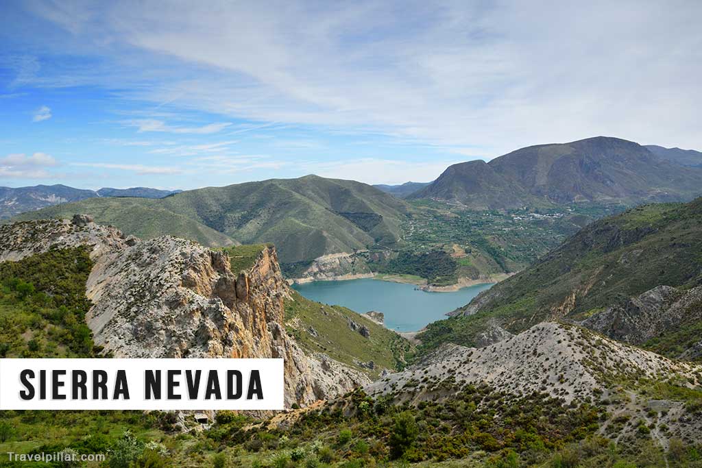
Beyond the ski zone, the Sierra Nevada National Park contains a network of marked trails and rural tracks suitable for hiking and mountain walking. Routes range from lower-altitude walks through pine forests to demanding ascents of Mulhacén and Veleta. The terrain reflects the range’s geological formation, with schist and slate formations contributing to steep gradients and exposed ridgelines. In summer, snow retreats to the highest elevations, revealing alpine meadows and endemic plant species.
The mountain range also plays a significant role in regional hydrology. Meltwater feeds rivers that irrigate agricultural land in surrounding valleys. Traditional irrigation channels, known as acequias, were developed during the Islamic period and continue to function in villages along the southern slopes. Small settlements such as those in the Alpujarras region are integrated into the foothills, combining agricultural terraces with mountain scenery.
Climatic conditions vary considerably with altitude. While coastal Andalusia experiences a Mediterranean climate, higher elevations can remain cool even during summer months. Weather changes can be rapid, particularly above 2,500 metres, and visitors undertaking mountain routes require appropriate preparation.
The Sierra Nevada offers a contrast to Spain’s urban heritage sites and coastal resorts. Its significance lies in altitude, biodiversity and seasonal variation. Whether visited for winter sports, long-distance walking or landscape observation, the range represents one of the country’s principal natural environments and a defining feature of inland Andalusia.
Official website (mountain resort): https://sierranevadagranada.com/en
Google map Sierra Nevada National Park 4.7/5
Sierra Nevada Top 5 Places of Interest
Mulhacén
Mulhacén rises to 3,479 metres and is the highest mountain in mainland Spain. It is accessible via marked hiking routes from the Alpujarras or from the Hoya de la Mora area. The ascent is demanding but does not require technical climbing in normal conditions. The summit provides wide views across Andalusia and, in clear weather, toward the Mediterranean coast.
Google map 4.8/5
Veleta
Veleta (3,398 metres) is the second-highest peak in the range and is notable for its proximity to the ski resort. A high-altitude road reaches close to the summit area, reducing the walking distance compared to Mulhacén. The peak offers panoramic views over Granada and the surrounding mountain system.
Google map Pico Veleta 4.8/5
Sierra Nevada Ski Station
Located near Pradollano, the ski station is one of Europe’s southernmost alpine resorts. It operates primarily in winter and provides lifts, marked pistes and associated services. The infrastructure allows structured access to high-altitude terrain without extended hiking.
Google map 4.4/5
Las Alpujarras
The Alpujarras villages lie along the southern slopes of the Sierra Nevada. Characterised by terraced agriculture and whitewashed houses, they reflect historical settlement patterns adapted to mountainous terrain. They function as starting points for hiking routes into the national park.
Lanjarón – often considered the western gateway to the Alpujarras, about 45 minutes from Granada. Google map
Órgiva – a central service town in the western Alpujarras. Google map
Pampaneira, Bubión and Capileira – a group of traditional white villages located high in the Poqueira Gorge beneath Mulhacén.
Google map Pampaneira
Google map Bubión
Google map Capileira
Trevélez – one of the highest villages in Spain, known for cured ham production. Google map
Vereda de la Estrella
Vereda de la Estrella is a historic mountain trail offering clear views of the northern faces of the highest peaks. The route follows a former mining path and is accessible from near Güéjar Sierra. It provides a structured walking option without requiring summit ascents.
Google map 4.8/5