
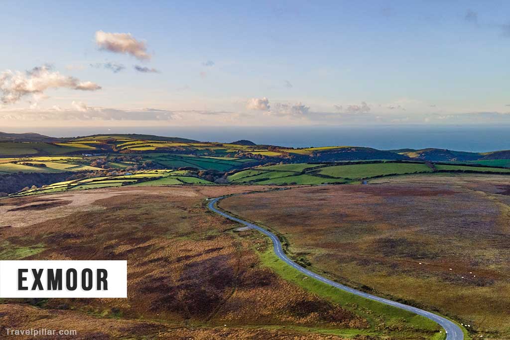
Exmoor National Park is a protected landscape spanning northern Devon and western Somerset, covering approximately 693 square kilometres of open moorland, wooded valleys, rolling hills and dramatic coastline. Designated a national park in 1954, Exmoor is renowned for its spectacular coastal scenery, traditional villages, free-roaming ponies and extensive walking routes. Its highest point, Dunkery Beacon, reaches 519 metres above sea level.
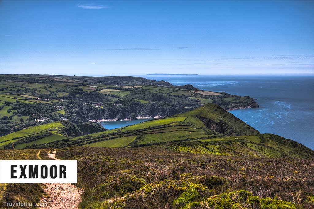
Unlike Dartmoor’s exposed granite landscape, Exmoor is characterised by rounded hills, deep river valleys, ancient woodland and towering coastal cliffs. The national park contains some of England’s most impressive coastal scenery, particularly around Lynton, Lynmouth and the Valley of Rocks. Visitors can explore historic settlements, discover waterfalls and wooded valleys or enjoy wildlife watching in one of southern England’s most important natural environments.
The Landscape of Exmoor
Exmoor’s distinctive landscape developed through millions of years of geological activity, weathering and erosion. Much of the underlying rock consists of Devonian sandstones and slates, formed approximately 400 million years ago. Rivers subsequently carved deep valleys through the hills, while coastal erosion created dramatic cliffs and rocky headlands. The resulting landscape combines open moorland, sheltered woodland and steep coastal valleys, providing a striking contrast to the granite tors of neighbouring Dartmoor.
Official website: https://www.exmoor-nationalpark.gov.uk
Google map 4.8/5
The Best Places to Visit in Exmoor National Park
Lynton and Lynmouth
Lynton and Lynmouth are two picturesque neighbouring settlements situated on Exmoor’s northern coastline. Lynton occupies an elevated position above the cliffs, while Lynmouth lies below at the meeting point of two rivers. The towns are connected by the historic water-powered Cliff Railway, opened in 1890. Visitors can explore the harbour, traditional shops and surrounding coastal scenery, with numerous walking routes into the national park.
Google map Lynton
Google map Lynmouth
Valley of Rocks
The Valley of Rocks is a spectacular dry valley situated approximately one mile west of Lynton. Renowned for its dramatic rock formations and impressive coastal views, the valley contains distinctive outcrops including Castle Rock and the Devil’s Cheesewring. Walking paths provide panoramic views across the Bristol Channel, while feral goats are frequently seen grazing among the rocks.
Google map 4.9/5
Exmoor Ponies
Exmoor ponies are one of the national park’s most recognisable features, with a history closely associated with the surrounding moorland. The hardy native breed is particularly well adapted to Exmoor’s exposed landscape and challenging weather conditions. Free-roaming herds can be encountered around Winsford Hill, Dunkery and other moorland areas. Although the ponies roam freely, they are owned and managed, and visitors should avoid feeding or approaching them.
Dunkery Beacon
Dunkery Beacon is the highest point on Exmoor, rising 519 metres above sea level. Situated on Dunkery Hill, the summit offers spectacular panoramic views across the national park, Bristol Channel and surrounding countryside. The open moorland is particularly attractive during late summer when heather covers the hillsides. Walking routes from nearby parking areas provide access to the summit.
Google map Dunkery Beacon 4.8/5
Google map Car Park
Tarr Steps
Tarr Steps is a remarkable ancient clapper bridge spanning the River Barle in a wooded valley near Dulverton. Constructed from massive stone slabs resting on supporting piers, the bridge is one of Exmoor’s most distinctive historic landmarks. Its precise origins remain uncertain, although the present structure is generally considered medieval. The surrounding woodland and riverside paths provide attractive walking opportunities.
Google map 4.8/5
Watersmeet
Watersmeet is a beautiful wooded valley situated near Lynmouth, where the East Lyn River meets Hoar Oak Water. Managed by the National Trust, the area contains rushing streams, waterfalls and ancient woodland. Scenic walking trails follow the river through the valley, while the historic Watersmeet House provides refreshments during seasonal opening periods.
Official website: https://www.nationaltrust.org.uk/
Google map Watersmeet House (National Trust) 4.7/5
Google map Watersmeet Road Car Park
Porlock and Porlock Weir
Porlock is a picturesque village situated on the eastern side of Exmoor, surrounded by attractive countryside and wooded hillsides. Nearby Porlock Weir is a small historic harbour containing traditional cottages, fishing boats and waterfront buildings. The surrounding coastline provides opportunities for walking and photography, while Porlock Hill is renowned for its steep gradient and impressive views.
Google map Porlock
Google map Porlock Weir
Heddon Valley and Heddon’s Mouth
Heddon Valley is a beautiful wooded river valley situated on Exmoor’s western coastline. A scenic walking route follows the River Heddon towards Heddon’s Mouth, a secluded rocky beach surrounded by towering cliffs. Managed in part by the National Trust, the valley provides excellent opportunities for woodland walks, wildlife watching and exploring the dramatic North Devon coastline.
Official website: https://www.nationaltrust.org.uk/
Google map Heddon’s Mouth 4.8/5
Google map Heddon Valley Car Park (National Trust)
Dunster Castle and Village
Dunster is a historic village situated on the northeastern edge of Exmoor, renowned for its medieval architecture, traditional cottages and impressive castle. Dunster Castle occupies a prominent wooded hill overlooking the village and surrounding countryside. Managed by the National Trust, the castle contains historic interiors, landscaped gardens and attractive walking trails. The village also features the distinctive medieval Yarn Market.
Official website: https://www.nationaltrust.org.uk/
Google map Dunster
Google map Dunster Castle 4.7/5
Exmoor Dark Sky Reserve
Exmoor was designated Europe’s first International Dark Sky Reserve in 2011, recognising the exceptional quality of its night skies. The park’s relatively low levels of artificial lighting provide excellent opportunities for observing stars, planets and astronomical events. Popular stargazing locations include Dunkery Hill, Wimbleball Lake and other open moorland areas away from settlements.
Google map Dunkery Hill 4.9/5
Google map Dunkery Hill Car Park
Google map Wimbleball Lake 4.7/5
Some More Things You Can Do
Walking and Hiking: Exmoor offers extensive walking routes across open moorland, wooded valleys and dramatic coastal cliffs.
Wildlife Watching: The national park supports red deer, birds of prey and numerous woodland and moorland species.
Cycling: Quiet country roads and designated trails provide opportunities for cycling through Exmoor’s varied countryside.
Food and Drink: Traditional village pubs, tearooms and cafés serve local produce and regional specialities.
Horse Riding: Exmoor’s bridleways and open countryside provide opportunities for guided riding and longer equestrian routes.