
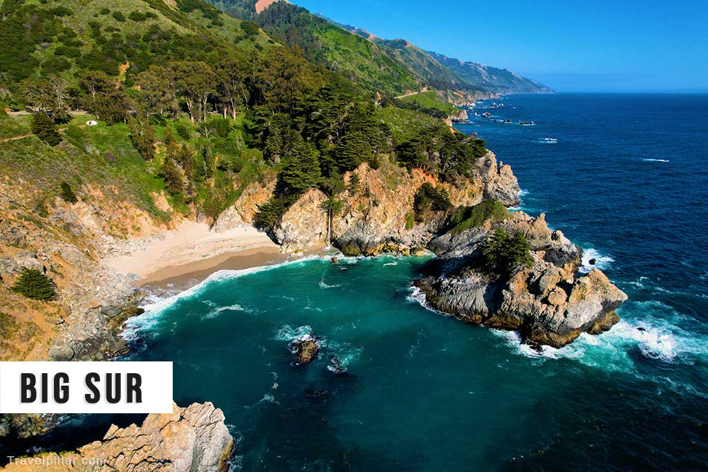
Big Sur is a rugged stretch of California’s central coastline, extending for about 90 miles along Highway 1 between Carmel in the north and San Simeon in the south. Bordered by the Pacific Ocean to the west and the Santa Lucia Mountains to the east, it is characterised by steep cliffs, narrow coves, and dense forests. Its dramatic scenery has made it one of the most photographed landscapes in the United States.
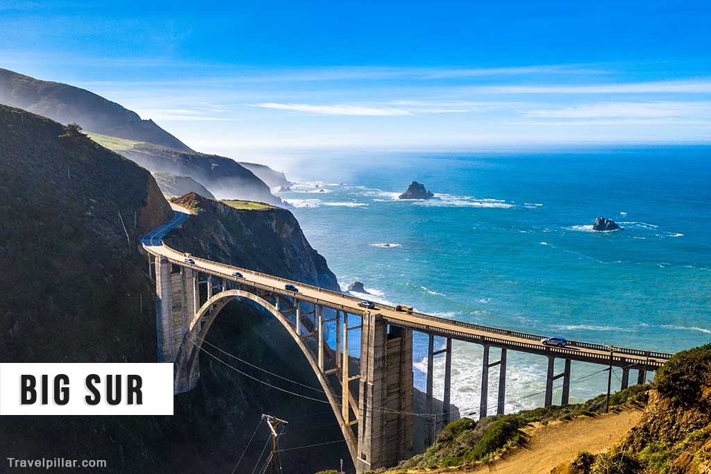
The region was sparsely inhabited until the 20th century, with settlements scattered among canyons and coastal terraces. Highway 1, completed in the 1930s, opened Big Sur to tourism while preserving its sense of remoteness. The road itself is a major attraction, with sharp turns, bridges, and viewpoints offering extensive vistas of the coastline and ocean. Bixby Creek Bridge, built in 1932, is among the most iconic landmarks.
Big Sur also contains several state parks that protect its natural features. Pfeiffer Big Sur State Park includes redwood groves, the Big Sur River, and hiking trails through canyons and ridges. Julia Pfeiffer Burns State Park is known for McWay Falls, an 80-foot waterfall that drops directly onto the beach. Garrapata State Park preserves coastal bluffs, wildflowers, and access to hidden beaches. Together, these parks highlight the variety of ecosystems in the region.
The area has long attracted writers, artists, and musicians. Figures such as Henry Miller and Jack Kerouac found inspiration in its landscapes, contributing to its cultural identity. Despite its popularity, Big Sur remains lightly populated, with small communities, lodges, and campgrounds serving visitors. Efforts to limit development have preserved much of its natural character.
Today Big Sur is recognised as both a scenic drive and a destination for hiking, camping, and photography. Its combination of cliffs, forests, and ocean views makes it one of California’s most distinctive and enduring natural attractions.
The Best of Big Sur
1. Bixby Creek Bridge
Built in 1932, Bixby Creek Bridge is one of the most recognisable features of Highway 1. Spanning 260 metres across a canyon, its concrete arch blends engineering with scenery. Viewing areas provide some of the best photo opportunities along the coast, symbolising Big Sur’s combination of natural beauty and infrastructure.
2. McWay Falls
Located in Julia Pfeiffer Burns State Park, McWay Falls is an 80-foot waterfall that drops directly onto the beach below. The viewpoint is accessible via a short trail and offers one of the most photographed scenes in Big Sur. The falls highlight the region’s dramatic meeting of land and sea.
3. Pfeiffer Big Sur State Park
Pfeiffer Big Sur State Park protects redwood groves, the Big Sur River, and trails through forested canyons and ridges. It offers camping, picnicking, and hiking opportunities, making it a central destination for visitors. The park reflects the natural diversity of the region and its long-standing role in conservation.
4. Garrapata State Park
Garrapata State Park preserves coastal bluffs, wildflowers, and hidden beaches along the northern Big Sur coast. Trails lead through canyons filled with redwoods and up to viewpoints overlooking the Pacific. Seasonal blooms of wildflowers add colour to the dramatic cliffs, making the park notable for both scenery and accessibility.
5. Point Sur Lighthouse
Point Sur Lighthouse, built in 1889, stands on a volcanic rock promontory along the coast. Tours provide access to the lighthouse and historic buildings, explaining its role in navigation and maritime safety. The site offers expansive views and reflects Big Sur’s maritime history as well as its rugged coastal environment.
6. Andrew Molera State Park
Andrew Molera State Park is one of the largest in Big Sur, with trails leading through meadows, along the Big Sur River, and out to coastal bluffs. Its relatively undeveloped character makes it less crowded than other parks. The park highlights the region’s varied habitats, from beaches to woodlands, within a single accessible area.
7. Pfeiffer Beach
Pfeiffer Beach is known for its purple-tinted sand and rock formations, including the Keyhole Arch, a natural sea arch that frames the setting sun at certain times of year. The beach is accessible via a narrow road and remains less commercialised than other coastal areas. Its distinctive geology makes it one of Big Sur’s most notable natural features.
8. Ventana Wilderness
The Ventana Wilderness, part of Los Padres National Forest, covers over 240,000 acres of rugged mountains and forests. It offers backcountry trails, campsites, and opportunities for solitude. The wilderness illustrates the scale and remoteness of Big Sur’s inland landscapes, contrasting with the more accessible coastal parks. It remains a key area for hiking and backpacking.
9. Henry Miller Memorial Library
The Henry Miller Memorial Library commemorates the American writer who lived in Big Sur in the mid-20th century. The site functions as a cultural centre, hosting exhibitions, concerts, and literary events. It reflects Big Sur’s role as a retreat for artists and writers, linking the natural landscape with its cultural identity.
10. Highway 1 Viewpoints
Driving along Highway 1 remains the defining experience of Big Sur. Numerous pullouts and viewpoints provide opportunities to stop and view the cliffs, coves, and ocean. The combination of engineering and landscape makes the highway itself a landmark. It illustrates how access to the coast has been achieved without undermining its natural character.