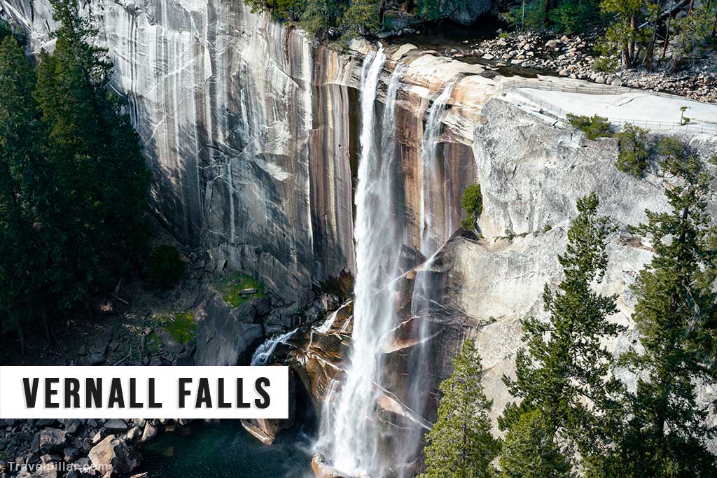
Vernal Fall is a prominent waterfall in Yosemite National Park, located on the Merced River along the Mist Trail. It has a vertical drop of 317 feet (97 metres) and is noted for its consistent flow throughout the year, although peak volume occurs in late spring and early summer when snowmelt from the Sierra Nevada is at its highest. By late summer, the flow diminishes, but unlike some seasonal falls in the park, Vernal Fall rarely dries completely.
The waterfall is best accessed via the Mist Trail, a popular hiking route that begins near Happy Isles in Yosemite Valley. The hike to the top of Vernal Fall is approximately 1.5 miles (2.4 kilometres) one way, with an elevation gain of about 1,000 feet (305 metres). The trail follows the river, passing the Vernal Fall Footbridge before ascending a steep granite staircase adjacent to the waterfall. During periods of high flow, the spray from the falls creates wet and slippery conditions along this section, giving the trail its name.
From the base and midway points on the trail, hikers have direct views of the falls framed by surrounding granite cliffs and forested slopes. At the summit, a fenced overlook provides a safe vantage point above the waterfall, offering views both upstream and down into the river gorge. The Emerald Pool, located just upstream, is a notable feature, though swimming is prohibited due to strong currents and hazardous conditions.
Geologically, Vernal Fall is the result of the Merced River flowing over a resistant granite ledge formed through erosion and glaciation. The uniform edge of the cliff contributes to the waterfall’s straight drop and symmetrical appearance.
Vernal Fall is also visible from certain points along the John Muir Trail, which provides an alternative, less steep descent from the top. The combination of accessibility, scenic views, and proximity to Nevada Fall further upstream makes it a frequent stop for visitors exploring Yosemite’s central trail network. As one of the park’s most photographed waterfalls, it is a significant feature both for its visual appeal and its role in illustrating the hydrology and geology of the Merced River corridor.
Google map 4.9/5