The UK National Trails are a network of long-distance walking routes that showcase some of the country’s most varied landscapes, including coastlines, rolling countryside, river valleys and upland terrain. Designed for walkers, with many sections also open to cyclists and horse riders, these trails are well waymarked and maintained to a consistent standard.
Each route highlights a different aspect of the UK’s natural and cultural heritage, passing through historic sites, rural villages and protected landscapes such as National Parks and Areas of Outstanding Natural Beauty. Trails vary in length and difficulty, from shorter coastal paths to multi-day routes that cross entire regions, making them suitable for both casual walkers and experienced hikers.
Official website: https://www.nationaltrail.co.uk/
National Trails in England
South Downs Way

The South Downs Way is a long-distance trail running from Winchester to Eastbourne across southern England. It follows a ridge of chalk hills, offering open views over the Weald and the English Channel. The route passes through grassland, farmland and small villages, and includes sections suitable for walking, cycling and horse riding. Its relatively gentle gradients make it accessible for a wide range of users.
North Downs Way
The North Downs Way runs from Farnham in Surrey to Dover in Kent, following the chalk escarpment of the North Downs. The route passes through woodland, farmland and historic sites, including churches, castles and ancient tracks. It offers views across the surrounding countryside and occasional glimpses of the English Channel. The trail is well marked and suitable for walkers, with some sections accessible to cyclists.
The Ridgeway
The Ridgeway is one of Britain’s oldest known routes, following high ground from Wiltshire to Buckinghamshire. Often referred to as Britain’s oldest road, it has been used for thousands of years. The trail passes prehistoric sites including Avebury and Iron Age hill forts. Much of the route follows open chalk ridges, providing wide views across the surrounding landscape and relatively dry walking conditions.
Thames Path
The Thames Path follows the course of the River Thames from its source in the Cotswolds to the Thames Barrier in London. The route passes through rural countryside, historic towns and urban areas, including Oxford, Windsor and central London. It provides a varied walking experience, combining riverside paths with sections through parks and streets. The trail is generally flat and suitable for a wide range of walkers.
South West Coast Path
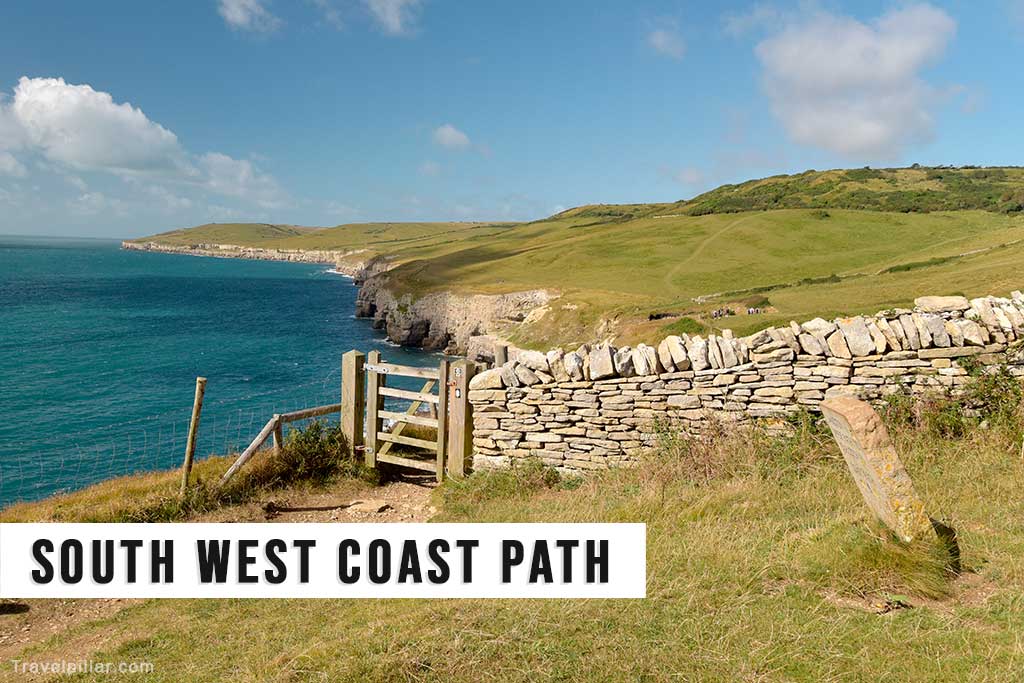
The South West Coast Path is the longest National Trail in the UK, stretching for 630 miles along the coasts of Somerset, Devon, Cornwall and Dorset. It follows cliff tops, beaches and coastal landscapes, offering extensive sea views. The route includes frequent ascents and descents, making it physically demanding in sections. It passes through coastal towns, fishing villages and areas of geological and historical interest.
Pennine Way
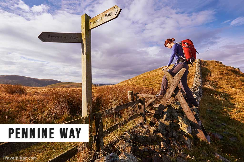
The Pennine Way is one of the UK’s most challenging long-distance trails, running from the Peak District to the Scottish Borders. It follows the Pennine hills, often referred to as the “backbone of England.” The route crosses moorland, upland terrain and remote landscapes, with sections exposed to changing weather conditions. It passes landmarks such as Hadrian’s Wall and High Cup Nick.
Pennine Bridleway
The Pennine Bridleway is a long-distance route designed for horse riders, cyclists and walkers, running through the Pennine hills. It connects the Peak District with northern England, using a mixture of tracks, trails and quiet roads. The route avoids steep gradients where possible, making it more accessible for different users. It passes through moorland, valleys and rural landscapes with limited traffic.
Cleveland Way
The Cleveland Way is a circular-style National Trail in North Yorkshire, combining inland and coastal sections. It runs along the edge of the North York Moors before following the coastline from Saltburn-by-the-Sea to Filey. The route offers a mix of moorland, woodland and cliff-top scenery, with views over the North Sea. It passes through small towns, fishing villages and historic sites along the coast.
Yorkshire Wolds Way
The Yorkshire Wolds Way crosses the chalk hills of East Yorkshire, running from Hessle to Filey. The route passes through rolling countryside, farmland and dry valleys, with relatively quiet surroundings compared to other trails. It offers wide views across the Humber Estuary and the North Sea. The trail is generally well maintained and suitable for walkers seeking a less crowded long-distance route.
Peddars Way and Norfolk Coast Path
Peddars Way and the Norfolk Coast Path combine to form a route linking inland and coastal landscapes in Norfolk. Peddars Way follows a Roman road through farmland and heathland, while the coastal section runs along beaches, salt marshes and cliffs. The trail passes nature reserves and areas important for wildlife. It is generally flat and accessible, making it suitable for a wide range of walkers.
Icknield Way Path
The Icknield Way Path follows an ancient route along the chalk escarpment from Buckinghamshire to Suffolk. It passes through rural landscapes, including farmland, woodland and open hills. The path is based on one of the oldest known trackways in England, historically used for trade and movement across the region. The trail offers a quieter experience compared to more well-known National Trails.
Hadrian’s Wall Path
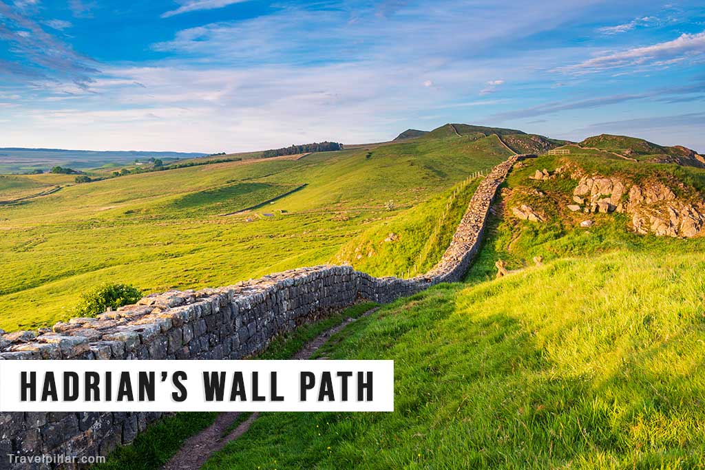
Hadrian’s Wall Path runs from Wallsend near Newcastle to Bowness-on-Solway on the west coast, following the line of the Roman frontier. The route passes forts, milecastles and other archaeological remains associated with the wall. It crosses urban areas, farmland and open countryside. The trail provides insight into Roman Britain and offers a combination of historical interest and varied landscapes.
Cotswold Way
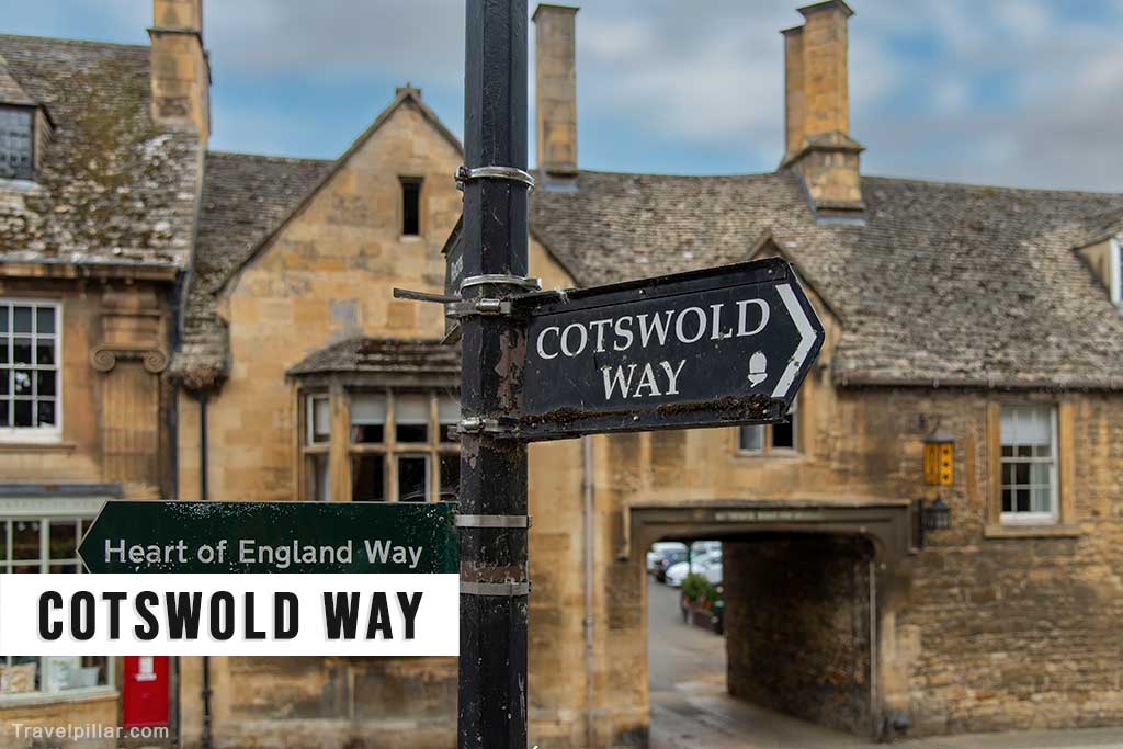
The Cotswold Way runs from Chipping Campden to Bath, following the western edge of the Cotswold hills. The route passes through villages, farmland and woodland, with views across the Severn Valley. It includes historic sites such as churches, manor houses and ancient monuments. The trail combines rural scenery with cultural heritage and is generally well maintained and clearly signposted.
Offa’s Dyke Path
Offa’s Dyke Path follows the line of the historic earthwork marking the border between England and Wales. The route runs from the Severn Estuary to the Irish Sea, passing through varied landscapes including hills, valleys and farmland. It offers views across both countries and includes sections of remote countryside. The trail highlights the historical significance of the boundary and its surrounding landscapes.
National Trail in Wales
Pembrokeshire Coast Path

The Pembrokeshire Coast Path follows the coastline of south-west Wales, covering around 186 miles. It passes cliffs, beaches, coves and headlands, offering continuous views of the Irish Sea. The route crosses areas of protected landscape within Pembrokeshire Coast National Park and is known for wildlife, including seabirds and marine life. The terrain varies, with frequent ascents and descents along the rugged coastal cliffs.
Glyndŵr’s Way
Glyndŵr’s Way is a circular-style route through mid-Wales, passing through remote countryside and small settlements. Named after the Welsh leader Owain Glyndŵr, the trail explores upland terrain, forests and farmland. It is one of the quieter National Trails, with fewer visitors than others in the UK. The route provides a more remote walking experience with limited facilities along certain sections.