

The Jurassic Coast Path in Dorset forms part of the South West Coast Path, extending from Studland Bay to Lyme Regis. It runs along the UNESCO World Heritage Site known for 185 million years of geological history.
This section of the route is defined by chalk cliffs, limestone headlands, fossil-rich beaches, and distinctive landforms shaped by erosion. Towns and villages along the path add cultural and industrial context, from fishing harbours to quarrying heritage.
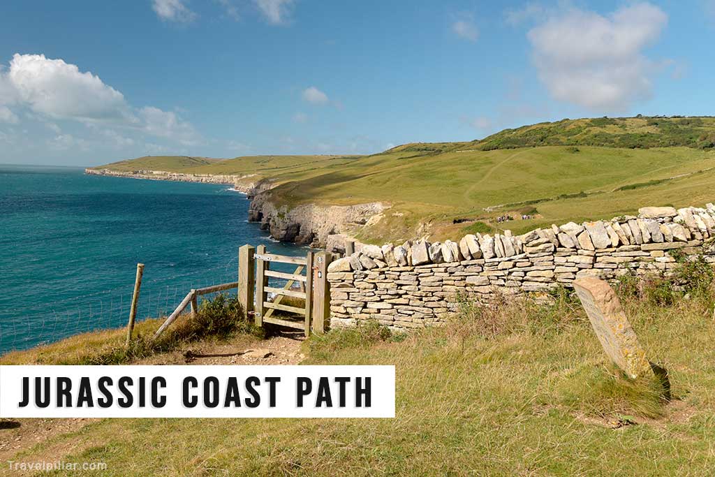
The walking experience along the Jurassic Coast Path is demanding in sections, with steep climbs and descents. However, it is accessible in stages, with shorter circular walks available from towns and villages along the route, including Swanage, Weymouth, and West Bay. Facilities such as car parks, visitor centres, and public transport connections support access to the path.
The highlights listed below represent the most distinctive points of the Dorset section of the Jurassic Coast Path, moving from east to west.
1. Studland Bay

Studland Bay includes Shell Bay, Knoll Beach, Middle Beach, and South Beach. Together, they form one of the longest sandy stretches on the Dorset coast. Backed by heathland and dunes, the beaches are important for conservation and popular for swimming, water sports, and walking. The South West Coast Path begins here, linking Studland with Old Harry Rocks and the wider Jurassic Coast.
Google map 5/5 Studland Bay
Google map 4.7/5 Shell Bay Beach
Google map 4.7/5 Knoll Beach
Google map 4.7/5 South Beach
Google map Studland Village
2. Old Harry Rocks
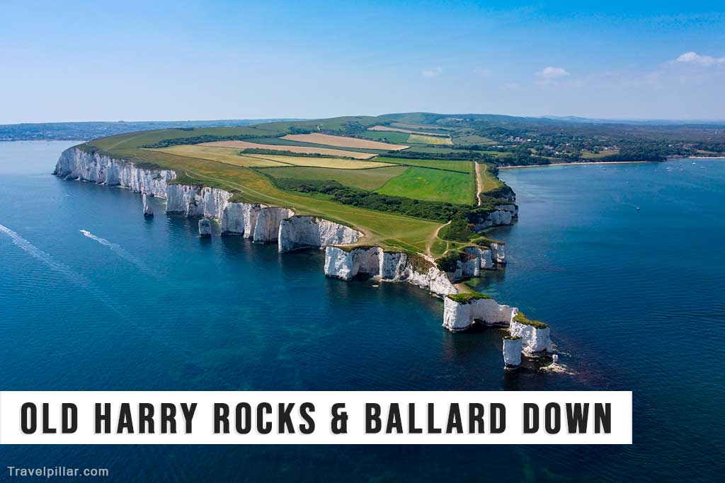
Old Harry Rocks are chalk sea stacks marking the eastern gateway to the Jurassic Coast. Formed by erosion of Purbeck’s chalk cliffs, they are continually changing. The rocks are accessible by footpaths from Studland and offer panoramic views across Poole Bay and towards the Isle of Wight. Their distinctive form makes them one of the most recognisable natural features in Dorset.
Official website: https://www.nationaltrust.org.uk/
Google map 4.8/5
3. Swanage

Swanage Bay is a sandy inlet backed by cliffs and overlooked by the South West Coast Path. It remains a traditional seaside resort with facilities for swimming, boating, and water sports. The promenade and seafront reflect its Victorian heritage, while the bay provides views towards Ballard Down and Old Harry Rocks. It is both a recreational area and a scenic feature of the Jurassic Coast.
Google map Swanage Beach 4.7/5
Google map Swanage Heritage Railway 4.9/5
Google map Durlston Country Park & Anvil Lighthouse 4.7/5
Google map Corfe Castle 4.7/5
Google map Brownsea Island 4.8/5
4. Durlston Country Park
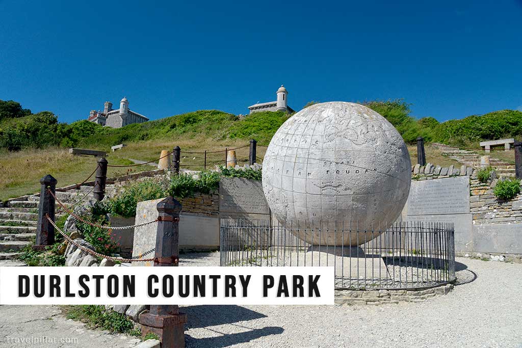
South of Swanage, Durlston Country Park combines cliffs, grassland, and woodland with geological features. It forms part of the Jurassic Coast and includes Durlston Castle, a restored Victorian building serving as a visitor centre. The park is also important for birdlife and butterflies, with well-marked walking trails. It serves as a gateway to longer sections of the coast path along Purbeck’s cliffs.
Official website: https://www.durlston.co.uk
Google map Durlston Country Park & Anvil Lighthouse 4.7/5
5. Dancing Ledge
Dancing Ledge is a flat rock platform at the base of the cliffs near Langton Matravers. It was once quarried for Purbeck stone and includes a small tidal swimming pool cut into the rock in the early 20th century. Today it is popular for walking, climbing, and coastal views. The ledge is reached via steep footpaths, making it a distinctive landmark on the path.
Google map 4.9/5
6. St Aldhelm’s Head
St Aldhelm’s Head is a limestone headland west of Swanage, known for its exposed cliffs and panoramic views. At its summit stands a 13th-century stone chapel, thought to have been used by seafarers. The site combines coastal scenery with historical features and offers perspectives across Purbeck and the English Channel. It is an exposed but rewarding section of the Jurassic Coast Path.
Google map St Aldhelm’s Head 5/5
Google map St Aldhelm’s Chapel 4.7/5
Google map Purbeck Radar Memorial 4.8/5
7. Kimmeridge Bay
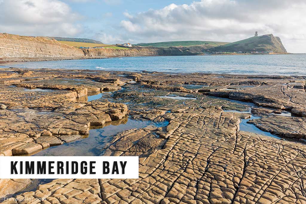
Kimmeridge Bay is a key geological site on the Jurassic Coast, known for its fossil-rich strata and exposures of oil shale. It is managed as part of a marine reserve, with a visitor centre explaining its significance. Rock pools and visible layers attract both scientists and visitors. The bay highlights the educational and scientific importance of the Jurassic Coast alongside its natural scenery.
Google map 4.6/5
8. Lulworth Cove

Lulworth Cove is a near-circular bay created by erosion of softer rock behind a narrow entrance. It is widely studied as a classic example of coastal geomorphology. Managed as part of the Lulworth Estate, it includes a heritage centre explaining its geology. The cove is one of the best-known and most visited landmarks of the Jurassic Coast Path, combining scientific interest with striking scenery.
Official website: https://lulworth.com/
Google map 4.7/5
9. Durdle Door
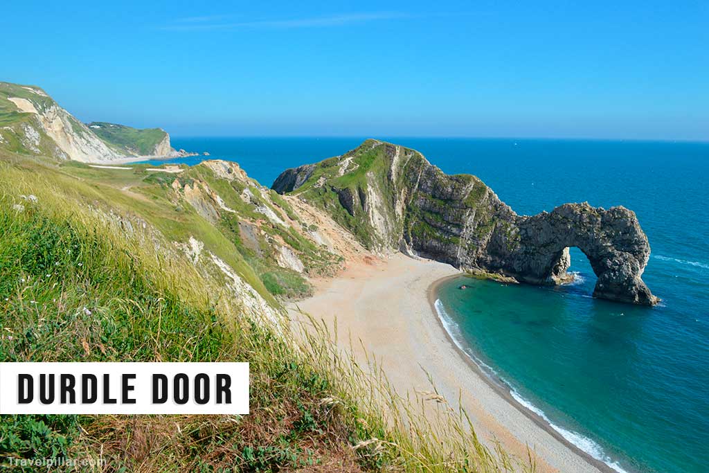
Durdle Door is a natural limestone arch located close to Lulworth Cove. Formed by wave erosion through a headland, it is one of the most photographed features of the Dorset coast. The site is accessible by footpath from the coast path and nearby car parks. Its distinctive form makes it both a geological landmark and a cultural symbol of the Jurassic Coast.
Official website: https://lulworth.com/
Google map Durdle Door 4.8/5
Google map Man O’War Beach 4.8/5
10. White Nothe
White Nothe is a chalk headland east of Weymouth, offering extensive coastal views. It is associated with smuggling and local folklore, adding cultural interest to the landscape. The South West Coast Path climbs steeply to the summit, rewarding walkers with panoramic perspectives of the Dorset coastline. It provides a dramatic contrast to the lower-lying areas further along the path.
Google map 5/5
11. Weymouth
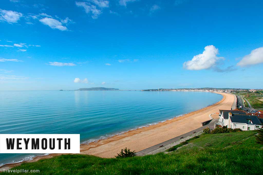
Weymouth Bay forms one of the largest sheltered inlets on the Dorset coast. Its long sandy beach, backed by Georgian architecture, reflects its development as a resort in the 18th and 19th centuries. The South West Coast Path runs along its seafront and harbour, linking it with Portland and Chesil Beach. The bay combines seaside recreation with coastal scenery and historic significance.
Google map Weymouth Beach 4.7/5
12. Chesil Beach
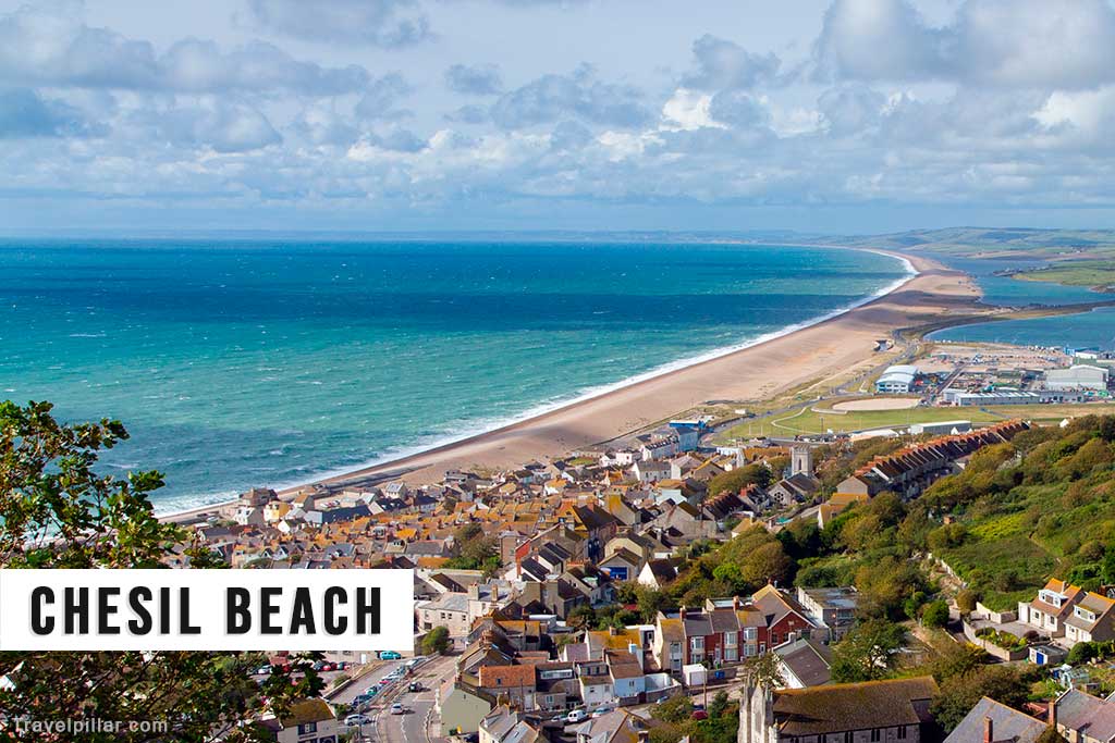
Chesil Beach is an 18-mile shingle barrier stretching from West Bay to the Isle of Portland. It separates the Fleet Lagoon from the English Channel and is internationally recognised as a coastal landform. The beach is best viewed from the coast path at Abbotsbury and Portland. Its scale, distinctive form, and scientific significance make it one of the defining features of the Jurassic Coast.
Google map 4.6/5
13. Isle of Portland
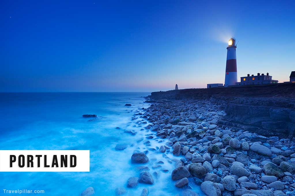
The Isle of Portland is a limestone peninsula connected to the mainland by Chesil Beach. It is known for its stone quarries, which supplied material for buildings across Britain, and for its maritime heritage. The coast path traverses its cliffs to Portland Bill, where a lighthouse overlooks the Channel. Portland combines geological importance with industrial and cultural history.
Google map Portland Bill Lighthouse 4.6/5
14. West Bay
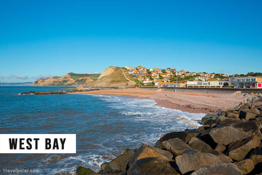
West Bay is a fishing harbour and resort west of Weymouth, backed by steep sandstone cliffs. The coast path follows the clifftops, providing views of erosion and landslips. The cliffs are a striking example of Jurassic Coast geology and have become well known through appearances in television and film. The harbour links the coastal scenery with active maritime use.
Google map West Bay Beach 4.6/5
15. Seatown
Seatown is a small coastal hamlet located between West Bay and Golden Cap. It is backed by high cliffs and accessed by narrow lanes. The South West Coast Path passes along its beach and surrounding slopes, providing views of Golden Cap to the west. Its shingle beach and quiet setting make it a less developed but scenic stop along the route.
16. Charmouth

Charmouth is one of the most important fossil-hunting locations on the Jurassic Coast. The cliffs and beaches yield ammonites and other prehistoric remains. The Charmouth Heritage Coast Centre provides guidance on safe collecting and explains the geology of the area. The site remains a focal point for linking the coast path with the palaeontological heritage of Dorset.
Google map Charmouth Beach 4.6/5
Google map Charmouth Heritage Coast Centre 4.6/5
17. Lyme Regis

Lyme Regis lies at the western end of the Dorset section of the Jurassic Coast Path. It is known for its harbour, called the Cobb, and its strong connections to fossil collecting. The town played a central role in early palaeontology, with figures such as Mary Anning. Lyme Regis combines geological interest with cultural heritage and is a natural conclusion to the Dorset stretch of the path.
Google map Lyme Regis
Google map Lyme Regis Beach 4.7/5
Google map The Cobb 4.6/5